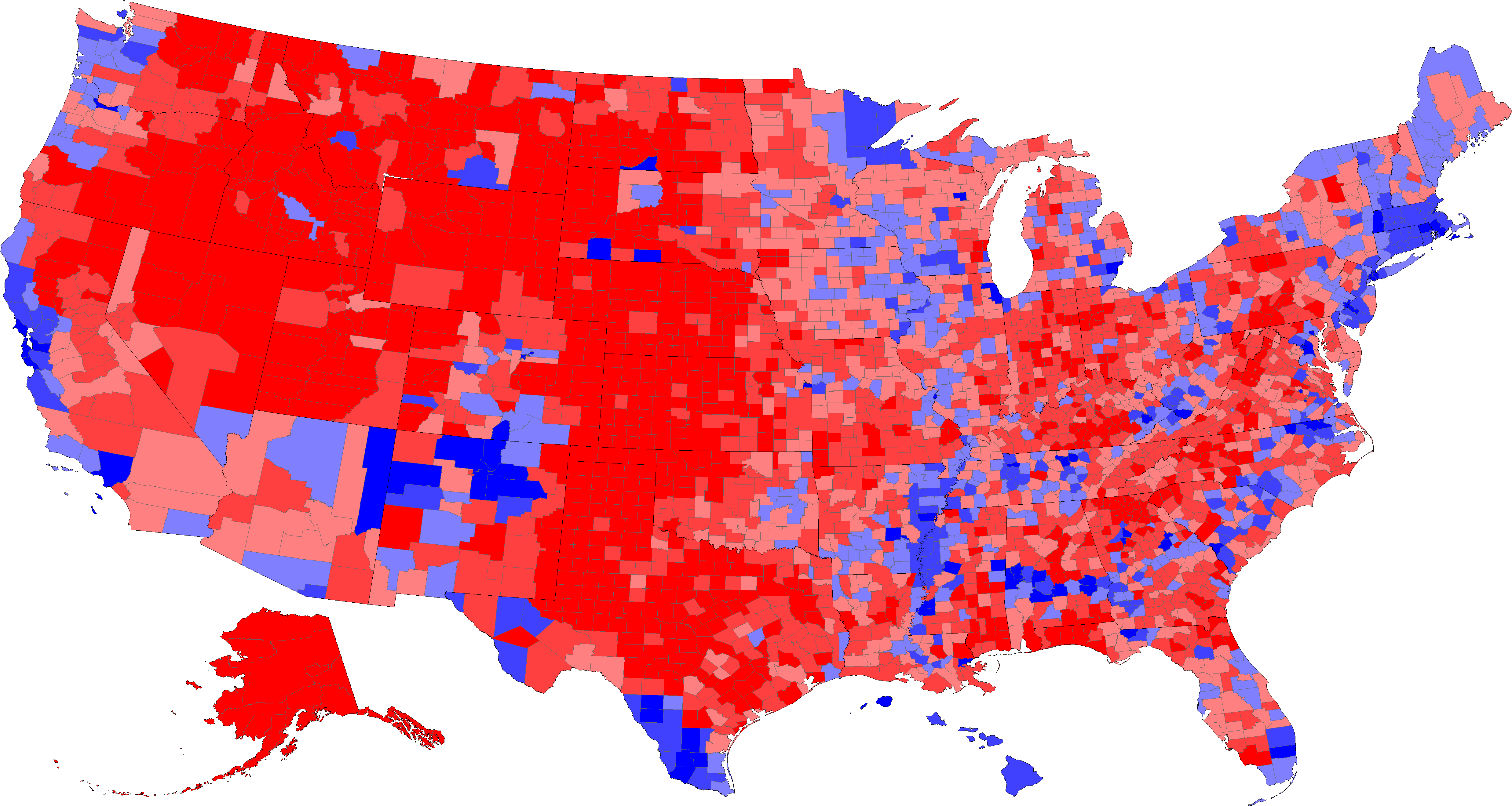
Data for the whole state of Alaska was masked onto every county (er, borough) in Alaska.
Data for the New England states was reported by township. The townships were mapped to their respective counties and the cumulative data for the county is presented here. In some cases, particularly in Maine, I could not figure out which county some of the townships were in, so their results were ignored. In general, these townships were quite small and would not have much of an effect on the countywide results.
| County-by-County* election results | |||
|---|---|---|---|
| Candidate | # of Counties | Population 1990 Census |
Area (sq. mi.) |
| Bush | 2463 | 114,542,960 | 2,543,701 |
| Gore | 675 | 98,099,895 | 492,357 |
* the usual caveats about what is a county apply
Gore swept the states of Massachusetts, Connecticut, Rhode Island, and Hawaii (and the District of Columbia).
Bush swept the states of Utah, Wyoming, Nebraska, and possibly Alaska.
If every county had an equal vote, then Bush would have won in a landslide. But, as I heard on the radio today, dirt can't vote.